Technology
Amplify your vision. Optimize your execution.
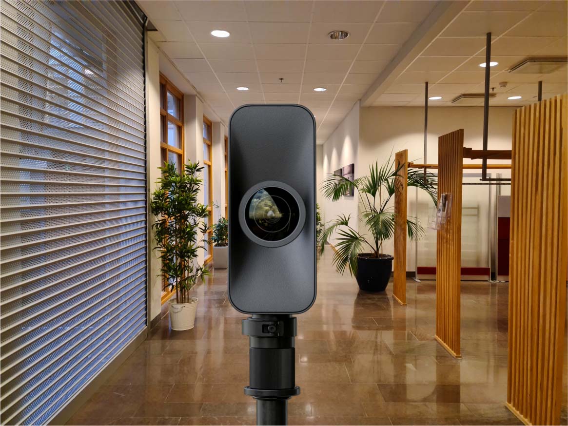
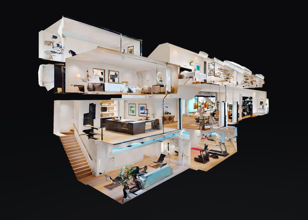
LiDAR Scanning
Our advanced LiDAR scanning technology creates hyper-realistic, data-rich digital twins of interior and exterior spaces with millimeter-level accuracy. Using cutting-edge laser-based capture, we document every room, surface, dimension, and spatial relationship—transforming physical environments into interactive 3D models you can access from anywhere. This intelligent documentation gives you precise measurements, verifiable conditions, and a single source of truth that your entire team can reference throughout a project lifecycle. The result is seamless collaboration, reduced site visits, and the elimination of costly measurement errors. From residential to commercial facilities, our LiDAR capture delivers the precision and detail that keeps projects on track, budgets intact, and stakeholders aligned from concept through completion.
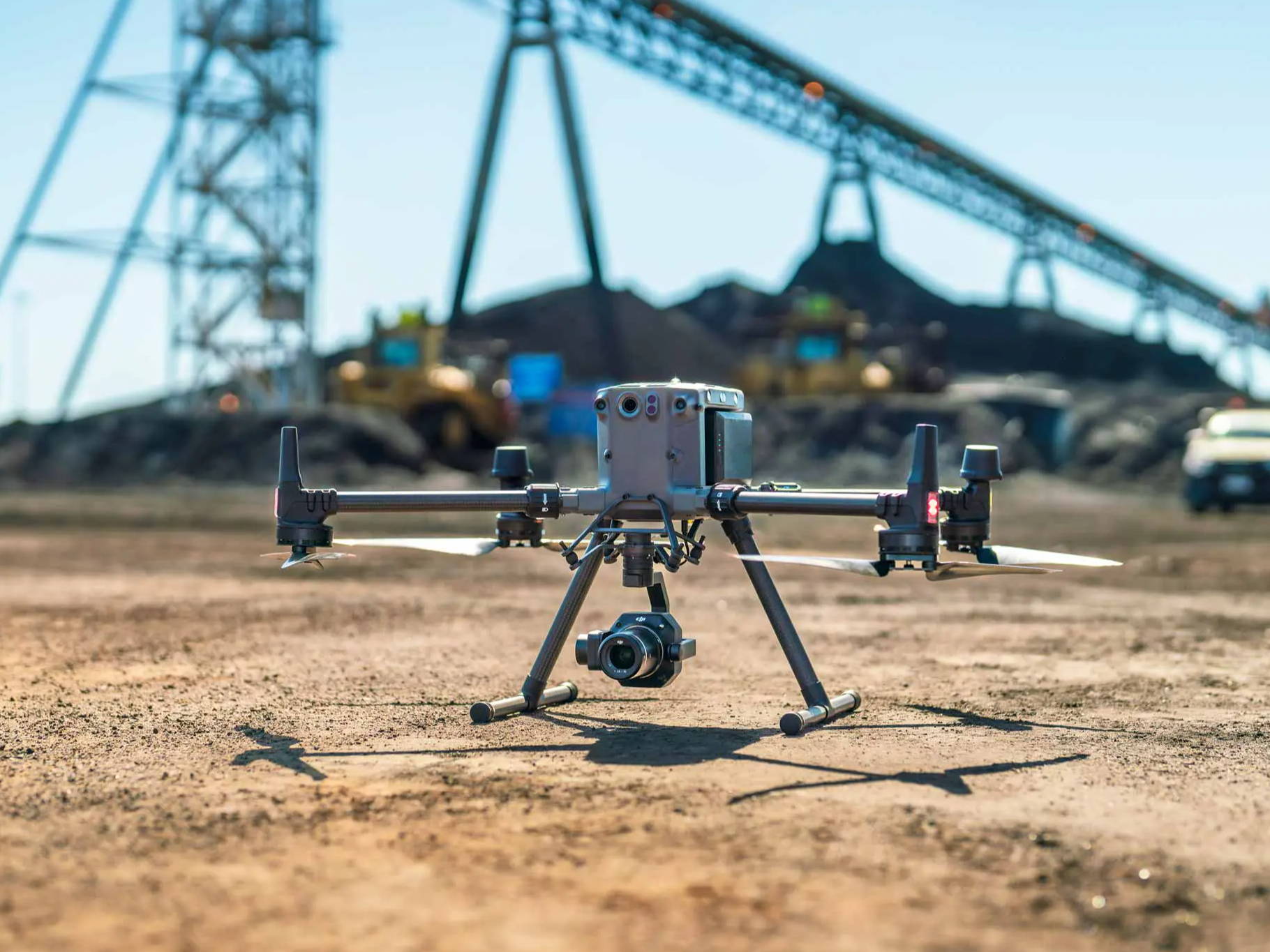
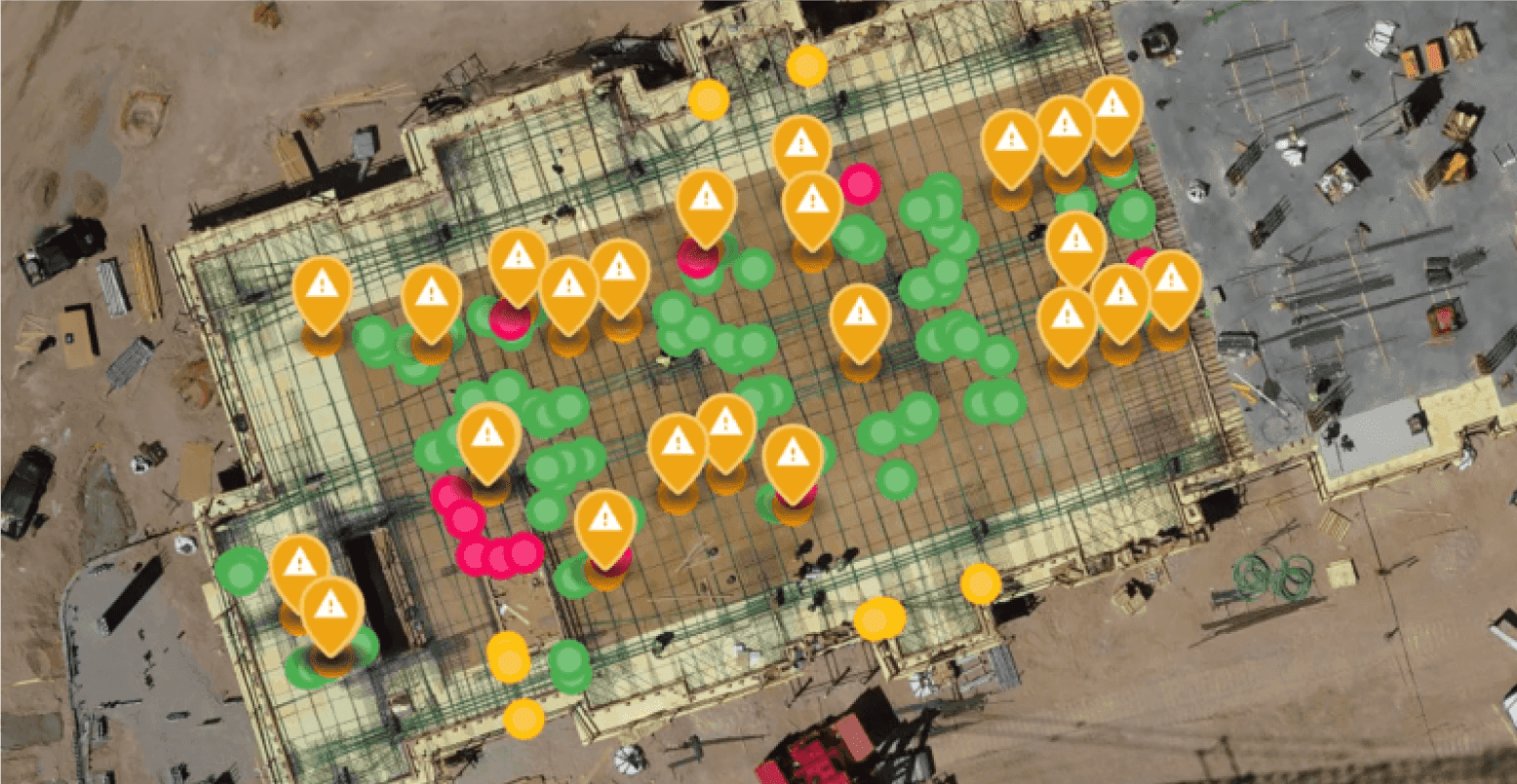
Drone Capture
Our licensed pilots utilize enterprise-grade drone technology to capture comprehensive aerial documentation of properties, sites, and structures with extraordinary precision. From rooftops and building exteriors to topography and site conditions, we document every detail from perspectives that ground-based capture simply can't reach. This aerial intelligence gives you complete visibility into exterior conditions, drainage patterns, access routes, and spatial context—all captured efficiently and safely without the risk or expense of manual inspection. The result is accurate baseline documentation that supports smarter planning, confident decision-making, and faster project execution. Whether you're assessing a single building or surveying an entire development site, our drone capture delivers the clarity you need to move forward with confidence.